How could someone be so wrong about Book of Mormon Geography (40+ years) such as the previous owner of this domain? Because Mormons are operating under the curse of a “darkened mind” (D&C 84:54-57).
It’s a fact,
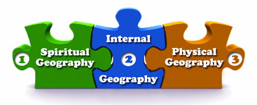
- Most Book of Mormon theorists do not have an Internal Geography Map. Did the previous owner of this domain take the time to fashion one? Unfortunately, no.
- Without an Internal Geography Map, it’s impossible to formulate an accurate Physical Geography Map.
- The Spiritual Geography is composed of Book of Mormon Land Promises and Land Prophecies.
- Without aligning the Book of Mormon’s Internal Geography with its Spiritual Geography, it would be impossible to identify its Physical Geography correctly.
While it’s true that Book of Mormon lands changed at the time of Our Lord’s coming, it’s not true that Book of Mormon land boundaries changed.

Where are the four seas (lakes) that surrounded only the Land Northward (Helaman 3:8) in the previous owner’s map? They don’t exist. It’s a waste of good time to plot cities before identifying land boundaries.
Secondly, it’s smart to identify all land distance references first. Had the previous owner of this domain done so, they would never have postulated such an enormous-sized model.
- They believed they were on an isle of the sea (2 Nephi 10:20; 29:7)
- The Land Northward was surrounded by water (Helaman 3:8)
- The Land Southward was nearly surrounded by water (Alma 22:32)
- The width of the land, from the East Sea to the West Sea, was 1.5 days wide (Alma 22:32)
- The length of the land (Alma 22:29) from Bountiful on the north (Alma 27:22) to Manti on the south (Alma 16:7; 22:27) was a day (Alma 43:18-24)
- The width from Zarahemla to the East Sea is less than a day (Alma 58:14, 24-25)
- The length of the Jaredite Land Northward was less than a day (Ether 15:8-11)
Third, disrespecting early modelers at one’s peril. The field of Book of Mormon Geography has done nothing but go in circles because every wannabe modeler takes a jab at it without respecting the work of those who have gone before, in particular, Professors John Clark and John Sorenson who already did the hard work of analyzing every geographical reference and concluded Book of Mormon lands were “tiny.”
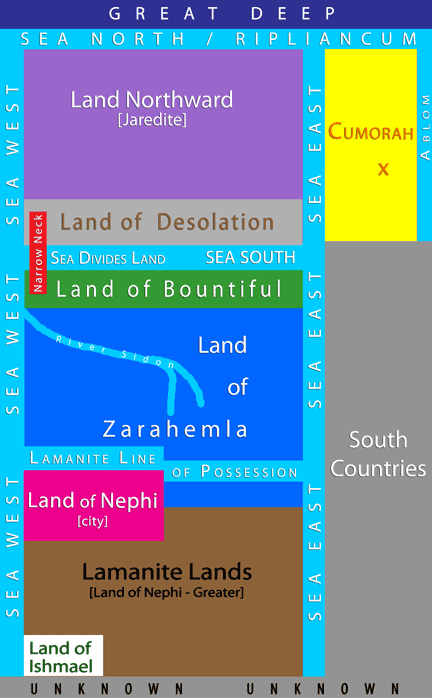
Here’s an example of an Internal Book of Mormon Geography Map. Create your own and demonstrate your understanding of the text first, in the abstract, without any physical land biases, i.e., not where church history was, not where you served your mission, grew up, vacationed, etc., including not later statements by Joe.
Just like additional records have been withheld from the current stewards of The Holy Book of Mormon, so too has its true geographical location been withheld by God the Father. The true geography demands that a person leave the Mormon Church, which is something few will do. If you have courage, read the following page: So Plain a Child Can Understand.